Performance Sea Kayak2
Get out and Paddle...
Time Trials: Scolt Head Island
A time-trial from Frank Harradence, in a beautiful part of the world.
The outward leg is a straightforward blast along the Northern seaward edge of Scolt Head Island, passing to the outside of the isolated shipwreck marker. With the tidal flow this is the fastest & most open stretch of the course. Turn right into the Burham Overy gap, now heading west you are on the scenic return leg. Navigate through the main creek that runs West into Brancaster Harbour, returning you to the beach Start/finish point. (Course details below).
Safety - Info Page
Scolt Head Island
Individuals
Number of Runs: 7| Pos. | K1W | Name | Cat | Club | Time | Date | Boat | Note |
|---|---|---|---|---|---|---|---|---|
| 1 | Frank Harradence | K1M | 01:54:27 | 05-Jul-18 | Rockpool Taran 16 | |||
| 2 | Frank Harradence | K1M | 01:55:48 | 14-Jun17 | Rockpool Taran 16 | |||
| 3 | Frank Harradence | K1M | 02:01:39 | 25-Feb-19 | Rockpool Taran 16 | |||
| 4 | Frank Harradence | K1M | 02:03:04 | 07-Sep-16 | Rockpool Taran 16 | |||
| 5 | Frank Harradence | K1M | 02:18:02 | 24-Apr-15 | Rockpool Taran 16 | |||
| 6 | (1) | Sally Harradence | K1W | 02:47:10 | 11-Jul-15 | Rockpool Alaw Bach | ||
| 7 | Frank Harradence | K1M | 02:48:52 | 14-Jun-21 | Rockpool Taran 16 |
Click column header to sort.
Scolt Head Island
Files Searched: 1
ScoltHead
From Frank Harradence:
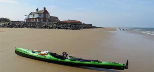
Parking update (18 Jun 21) Ample public parking is available close to the start/finish point at £8.00 per day (or £4 for 2hrs for you fast types!) There are no gate barriers to worry about for high roofed vans. Pleased to say that the best beach cafe ever is still open with very reasonable prices and a friendly fast service.🍦🍔☕️ Public toilets remain open and well cared for. The start/finish point is on the public beach just to the front of the large golf club building & the public entrance onto the beach.
The outward leg is a straightforward blast along the Northern seaward edge of the Island, passing to the outside of the isolated shipwreck marker. With the tidal flow this is the fastest & most open stretch of the course. Turn right into the Burham Overy gap, now heading west you are on the scenic return leg. Gun Hill is a good marker for this turn in point. Navigate through the main creek that runs West into Brancaster Harbour, returning you to the beach Start/finish point.
The key to a non stressful circumnavigation is ensuring that you judge the correct water levels through the creek's on the return leg. Water levels drop very fast here and sand/shingle banks are soon exposed, causing one to hunt out the deeper water or get stranded until the next tide!
I left the beach on a 7.9mtr tide at 1hr 20min before HW at Brancaster Staith, which seemed about right. (Faster paddlers could choose to leave a little later) I would not recommend doing this trip on a smaller tide.
Try not to enter any 'false' creeks. It looks obvious on the map but being low on the water they are hard to pick out, and their entrance points are on a similar enough compass bearing to create navigation doubts. Finally Westerly winds; great on the outward leg but on the return, they seem to be funnelled between the Island & mainland upping their strength causing a hard slog back.
Footnote:
The regular pay and display car park at the Brancaster beach start point is evidently liable to flooding on high Springs. At 8.6 it has been fine but a 9 to 9.3 may see it flood, therefore it's best to park elsewhere and paddle to the beach start point before starting out on the course.
Try and avoid Northerly winds altogether, particularly North Easterlies, they make playing in small boats generally difficult off the Norfolk coast.